DAY 2, Friday, DEC 16, 2011:


We've been to Colca Canyon in Peru which is deeper than the Grand Canyon. We've seen the awesome canyon in Zagori region in Greece. So how does the Grand Canyon compare? Our verdict... all are GREAT in their own way, some get more hype that's all!!
We started off early from our hotel in Vegas with just stuff for the 3 night stay at the Grand Canyon. Might as well not have bothered with different inner layers as only our heavy winter coat above the layers was visible and we were swaddled in beanies, scarves, gloves through out as the maximum temperature was below freezing all 3 days in the Grand Canyon National Park.
In summer it is recommended to park your car and use the Park's free shuttle service to go from one view point to another as the road will be jam packed. But in winter we drove the south rim and enjoyed all the view points.
We started off early from our hotel in Vegas with just stuff for the 3 night stay at the Grand Canyon. Might as well not have bothered with different inner layers as only our heavy winter coat above the layers was visible and we were swaddled in beanies, scarves, gloves through out as the maximum temperature was below freezing all 3 days in the Grand Canyon National Park.
WHY DRIVE?
In summer it is recommended to park your car and use the Park's free shuttle service to go from one view point to another as the road will be jam packed. But in winter we drove the south rim and enjoyed all the view points.
WHERE TO GO:
CHOOSE A RIM....NORTH /SOUTH / WEST RIM?
Grand Canyon has 6 million visitors per year.
WEST RIM: Out of that total, West Rim attracts about
700,000 visitors each year. West Rim has become increasingly popular since the March 2007 grand opening of the Grand
Canyon Skywalk. This cantilevered glass-bottomed bridge is just 2 ½
hours from Las Vegas and appeals to adrenaline seekers. West Rim's NOT a part of Grand Canyon
National Park, West Rim's operators are the Hualapai Native American
Tribe. [ so separate entry fees of general $60, with additional $26
for skywalk, no cameras allowed on skywalk], Grand Canyon West's visitors experience stunning vistas at Guano Point, Eagle Point,
and Hualapai Ranch.
NORTH RIM: North Rim receives only 1/10th of the
visitation that the South Rim does. It's 1,000’ higher in altitude, only
open from mid-May through mid-October due to heavy snowfall during
the winter months. It is also less accessible from most major
Western cities than the South Rim (6 hours from Las Vegas, 8 hours
from Phoenix, 7 hours from Salt Lake City)
The main visitation area of Grand
Canyon North Rim is much smaller than that of the South Rim.
While the South Rim has close to two dozen major viewpoints, the
North Rim has only three. The views themselves are also much
different than what one sees from the other side – while the views
from Grand Canyon South Rim tend to reveal the depth of the Grand
Canyon, the views from the North Rim are more about the width.
The Colorado River is visible from
several viewpoints at the South Rim, while from the North Rim, one
has to peek through Angel’s Window in order to see a small sliver
of the river. But those who have seen the canyon from both
sides tend to agree that the North Rim is the nicer side of the Grand
Canyon, in several senses of the word – calmer, quieter, and
reminiscent of what the National Parks may have been like in years
past.
Visitor services at Grand Canyon North
Rim are fewer in number and smaller in scale than at the South Rim.
The Grand Canyon Lodge is the only in-park lodge at the North Rim.
SOUTH RIM: Grand Canyon South Rim is most
frequently chosen not only for its
beautiful views, but for its abundance of visitor services and
family-oriented activities. The South Rim is open year-round.
Considered by many to be the “true Grand Canyon,” Grand Canyon
National Park’s South Rim features the vast, expansive views most
often seen in magazines, and on TV.
From the South Rim, we can experience
the Grand Canyon from close to two dozen viewpoints, each with their
own unique attributes, and many that allow us to peer all the way
down into the heart of the Grand Canyon, the Colorado River.
Approximately 5 hours from either Phoenix or Las Vegas, the South Rim
is the most easily accessible from most major Western cities. It has many
lodges inside including our choice Maswick Lodge, ¼ mile South of the
Canyon Rim .
So no brainer really... we chose SOUTH
RIM!
is the official site with all relevant
details for planning. As is usual with all US national parks, there are in depth details on the official site
Distance from Las Vegas to Grand Canyon
- South Rim, is 275 miles, about a five-hour drive. (US-93 south to
Kingman, AZ; I-40 east to Williams, Arizona; AZ-64 north to South Rim). Here's our driving route:
https://goo.gl/maps/8eJC35MP6nLsZBqRA
Here We are filling up at Kingman. Had our packed breakfast here as well...
Here We are filling up at Kingman. Had our packed breakfast here as well...


Get the terminology right:
Now to get the terminology right...A valley is a low-lying area of land surrounded by high areas, such as mountains or hills....A canyon is a type of erosional valley with extremely steep sides, forming vertical cliff faces. “Gorge” is often used interchangeably with “canyon” and implies a smaller, narrow feature.HOW DID THIS CANYON FORM?
Grand Canyon achieved National Park status in 1919, it receives five to 6 million visitors each year. Grand Canyon National Park, encompasses 1,218,375 acres. In Grand Canyon’s geologic history the story begins almost two billion years ago with the formation of the igneous and metamorphic rocks of the inner gorge. Above these old rocks lie layer upon layer of sedimentary rock.
Between 70 and 30 million years ago, through the action of plate tectonics (movement of the earth's plates), the whole region was uplifted, resulting in the high and flat Colorado Plateau.
Just 5-6 million years ago, the Colorado River began to carve its way downward... erosion by tributary streams led to the canyon’s widening. While traversing the Colorado Plateau, the Colorado River slices like a knife through a layer cake of sedimentary rock, carving a series of spectacular canyons in southeast Utah and northern Arizona....Located entirely in northern Arizona, Grand Canyon is the final point before the river leaves the plateau and makes its push to the ocean…Grand Canyon and its side canyons cut through over a mile of rock, from the heights of 9,200 feet above sea level on the North Rim down to 1,200 feet above sea level by the time the Colorado River reaches Lake Mead
Still today these forces of nature are at work slowly deepening and widening the Grand Canyon. Remember, the oldest rocks in Grand Canyon are 1.8 billion years old.
The canyon is much younger than the rocks through which it winds. Even the youngest rock layer, the Kaibab Formation, is 270 million years old, many years older than the canyon itself.
WHY IS THIS CANYON GRAND?
Grand Canyon is home to numerous rare, endemic (found only at Grand Canyon), and specially protected (threatened or endangered) plant and animal species. Unique combinations of geologic color and erosional forms decorate this canyon that is 277 river miles (446 km) long, up to 18 miles (29 km) wide, and a mile (1.6 km) deep.
The Grand Canyon is considered one of the natural wonders of the world because of its natural features. The exposed geologic strata - layer upon layer from the basement Vishnu schist to the capping Kaibab limestone - rise over a mile above the river, representing one of the most complete records of geological history that can be seen anywhere in the world.
Geologic formations such as gneiss and schist found at the bottom of the Canyon date back 1,800 million years. This geologic incline creates a diversity of biotic communities, and five of the seven life zones are present in the park.
The aspect, or direction a slope faces, also plays a major role in adding diversity to the Grand Canyon. North-facing slopes receive about one-third the normal amount of sunlight, so plants growing there are similar to plants found at higher elevations, or in more northern latitudes. The south-facing slopes receive the full amount of sunlight and are covered in vegetation typical of the Sonoran Desert.
Distinct habitats are located at different elevations along the 8,000 foot elevation gradient. Near the Colorado River, riparian vegetation and sandy beaches prevail. Just above the river corridor a desert scrub community exists complete with a wide variety of cacti and warm desert scrub species. A pinyon pine and juniper forest grows above the desert scrub up to 6,200 feet, while between 6,200 feet and 8,200 feet ponderosa pine is abundant. On the North Rim at elevations above 8,200 feet, a spruce-fir forest tops out the park.
Distinct habitats are located at different elevations along the 8,000 foot elevation gradient. Near the Colorado River, riparian vegetation and sandy beaches prevail. Just above the river corridor a desert scrub community exists complete with a wide variety of cacti and warm desert scrub species. A pinyon pine and juniper forest grows above the desert scrub up to 6,200 feet, while between 6,200 feet and 8,200 feet ponderosa pine is abundant. On the North Rim at elevations above 8,200 feet, a spruce-fir forest tops out the park.
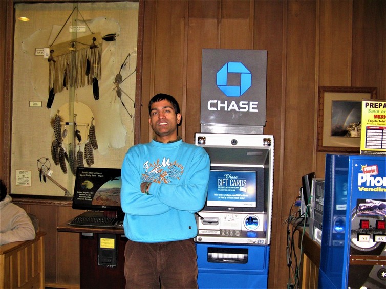
We drove to our MASWICK lodge right inside
the grand canyon national park when it became dark, checked in.


Already felt we had achieved the goal of our visit as we had had stunning views of the Grand Canyon. Even if weather turned sour we did not stand to lose much!
DAY 3, Saturday, DECEMBER 17, 2011:
DESERT VIEW DRIVE:
Started off on Desert View Drive--- a scenic route to the east of Grand Canyon Village on the South Rim which follows the rim for 25 miles (40 km) out to the Desert View Watchtower and East Entrance. Along the way, six developed canyon viewpoints, four picnic areas, and five unmarked pullouts are accessible with private vehicles, in addition to the Tusayan Ruin and Museum. Here Buddha temple, in the background.Here's a map... the white route leading to the right is Desert view drive; the red route leading left is the Hermit trail we took after. All view points are marked


Driving on the south rim is awesome in
December without the pesky crowds in peak season
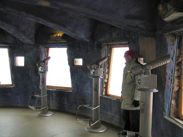
Desert View Watch tower here...
 The Desert View Watchtower (1932) is one of several buildings at Grand Canyon designed by Mary Colter, architect for the Santa Fe Railroad. It is a replica of a prehistoric Indian tower, commands a magnificent view of the Grand Canyon, the Painted Desert to the east and the San Francisco Peaks to the south. This 70 foot (21 meter) tower is the highest point on the South Rim. The building sits out on a promontory overlooking the Grand Canyon.

 inside there are murals by Hopi painter Fred Kabotie and there are 85 steps to the observation deck for a 360 degree view The ground level of the tower is a large, round observation room with a spectacular view of the Grand Canyon.
Building a structure that provides the widest possible view of the Grand Canyon yet harmonizes with its setting was architect Mary Colter's goal when the Santa Fe Railroad hired her in 1930 to design a gift shop and rest area at Desert View Point....look for the white decorative stones near the top, which fade out as the eye goes around the tower. She had seen this pattern at Chaco Canyon and thought it would break the monotony of this Watchtower. The built in cracks which are patterned from some of the ancient towers she had seen are deliberately designed.


 Standing at 70 feet, with a 30-foot base, the tower has a concrete foundation and a steel framework well hidden in the stones.

 From inside the watch tower we had a panaromic view. The outdoor observation area below... it is closed in winter…


Building a structure that provides the widest possible view of the Grand Canyon yet harmonizes with its setting was architect Mary Colter's goal when the Santa Fe Railroad hired her in 1930 to design a gift shop and rest area at Desert View Point....look for the white decorative stones near the top, which fade out as the eye goes around the tower. She had seen this pattern at Chaco Canyon and thought it would break the monotony of this Watchtower. The built in cracks which are patterned from some of the ancient towers she had seen are deliberately designed.


HERMIT TRAIL:
Next we were on the hermit trail. It's a privilege to drive the hermit trail as it's open only Dec--Mar. Hermit Road is a scenic route along the west end of Grand Canyon Village on the South Rim which follows the rim for 7 miles (11 km) out to Hermits Rest. This extremely popular route is accessed by free park shuttle bus, foot, bicycle, or commercial bus tour most of the year, with private vehicles allowed only during winter months of December, January and February.


 2 mooses here...
 The Kaibab Limestone, the uppermost layer of rock at Grand Canyon, was formed at the bottom of the ocean. Yet today, at the top of the Colorado Plateau, the Kaibab Limestone is found at elevations up to 9,000 feet. How did these sea floor rocks attain such high elevations?


 After sunset... we hurriedly made our way back to our lodge at 5 PM as darkness descends swiftly in the hills in winter and we did not want to face the risks associated with driving on icy roads in the dark...obviously, there are no electric lights in the park…


Reached the last point on the hermit trail, Hermit's Rest.


 A snack bar opens on the west side of the space, and the"rug room," where native crafts are sold, is on the east side with its own fireplace. The interior furnishings throughout were chosen by Colter and are part of the historic designation. The overall impression imparted by Colter's design is one of antiquity. Colter, when kidded by AT&SF executives about the dark, antique-looking interior, retorted "you can't imagine what it cost to make it look this old…

 The building is designed to appear to be a natural stone formation, closely tied to the land.
We were back at our lodge by 10, packed up, and checked out by 11 and drove on to our hotel in Vegas. Took a wrong turn and entered California by mistake, then got on our right route and reached our hotel. We had a reservation to Cirque d'soleil show but were too fatigued to go collect our tickets and see it.
Anyway, our Grand Canyon visit had been beyond AMAZING!
Vegas report continues here:
https://adventuretrav.blogspot.com/2020/05/nevada-holiday-las-vegas-day-5.html


The Powell Memorial at this viewpoint commemorates the 1869 and 1871-72 exploratory trips down the Colorado River by Major John Wesley Powell and expedition crews

HOPI POINT SUNSET:
Hopi Point is one of the most popular viewpoints for watching the sunset and sunrise because of its wide vistas. The Colorado River comes into view to the west. We had an awesome experience seeing the myriad colors coming alive with the stroke of the setting sun's caress!
Hopi Point is one of the most popular viewpoints for watching the sunset and sunrise because of its wide vistas. The Colorado River comes into view to the west. We had an awesome experience seeing the myriad colors coming alive with the stroke of the setting sun's caress!


DAY 4, Sunday, DECEMBER 18, 2011:
We finished the rest of our trail before checking out at 11am and driving back to Vegas..
Pima Point is one of the best places on the rim to see and sometimes hear the river. The splash and grind of Granite
Rapids below can be heard echoing up the canyon walls on quiet days.


Reached the last point on the hermit trail, Hermit's Rest.

The entrance to Hermit's Rest building is approached by a path that passes this stone arch decorated with a broken bell that Colter salvaged from a Spanish mission in New Mexico....


A small porch supported by peeled log
posts stands to one side of the outside observation area that
overlooks the canyon rim. ...The low porch roof extends into the
interior, which opens up to a double-height space. Opposite the
entry, the south wall houses a semi-circular alcove with a fireplace
and a raised floor.


We were back at our lodge by 10, packed up, and checked out by 11 and drove on to our hotel in Vegas. Took a wrong turn and entered California by mistake, then got on our right route and reached our hotel. We had a reservation to Cirque d'soleil show but were too fatigued to go collect our tickets and see it.
Anyway, our Grand Canyon visit had been beyond AMAZING!
Vegas report continues here:
https://adventuretrav.blogspot.com/2020/05/nevada-holiday-las-vegas-day-5.html
No comments:
Post a Comment