arrived at Hvitserkur, a dragon-shaped basalt stack standing on
the eastern shore of Vatnsnes.
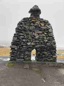
HVITSERKUR:
Hvitserkur is a 15 meter (49 ft) tall
cliff jutting out straight from the sea. It has a unique shape
resembling a giant dinosaur or a cow enjoying a drink from the ocean.
Sea erosion has carved out unique holes in the shape where many types
of seabirds, especially gulls and fulmars, have made their nests for
centuries. Their guano deposit has made its mark on the cliff,
painting it white in many places. Hence the cliff is named
Hvitserkur. Hvitserkur translates as white shirt.
Due to the never ending onslaught of
the tireless sea the base of the stack has been reinforced with
cement to protect and maintain it. The cliff is mostly basalt.
We parked and walked to the viewing platform to the left.
 The legend goes that Hvitserkur is a petrified troll. A troll lived in Strandir, east of the Hvitserkur, and was bothered by the bells at Þingeyrakirkja church. Crossing the sea on its way to tear down the church bells, the troll got caught by daylight and ... as we all know trolls turn into stone when the sun hits the sky.
When tide is low, we can walk right
out to the formation. From the observation platform one can clamber
down. This is NOT easy. There is a path to the right of the parking
lot, and requires a long walk down the beach to reach the rock
formation (like 10-15 minutes) however it is a FAR easier path to get
up and down.
I had read the arctic terns nesting there don't let
people walk thru... they attack persistently and draw blood! Anyway,
we did not encounter any birds nesting except fulmars flying around.
From below we get a good look at the
water fall and saw some fulmars nesting in the cliff as well.
Fulmars nesting in the cliff...
Can see the observation platform, the waterfall and the fulmar nest on the cliff...
People clambering down the cliff...
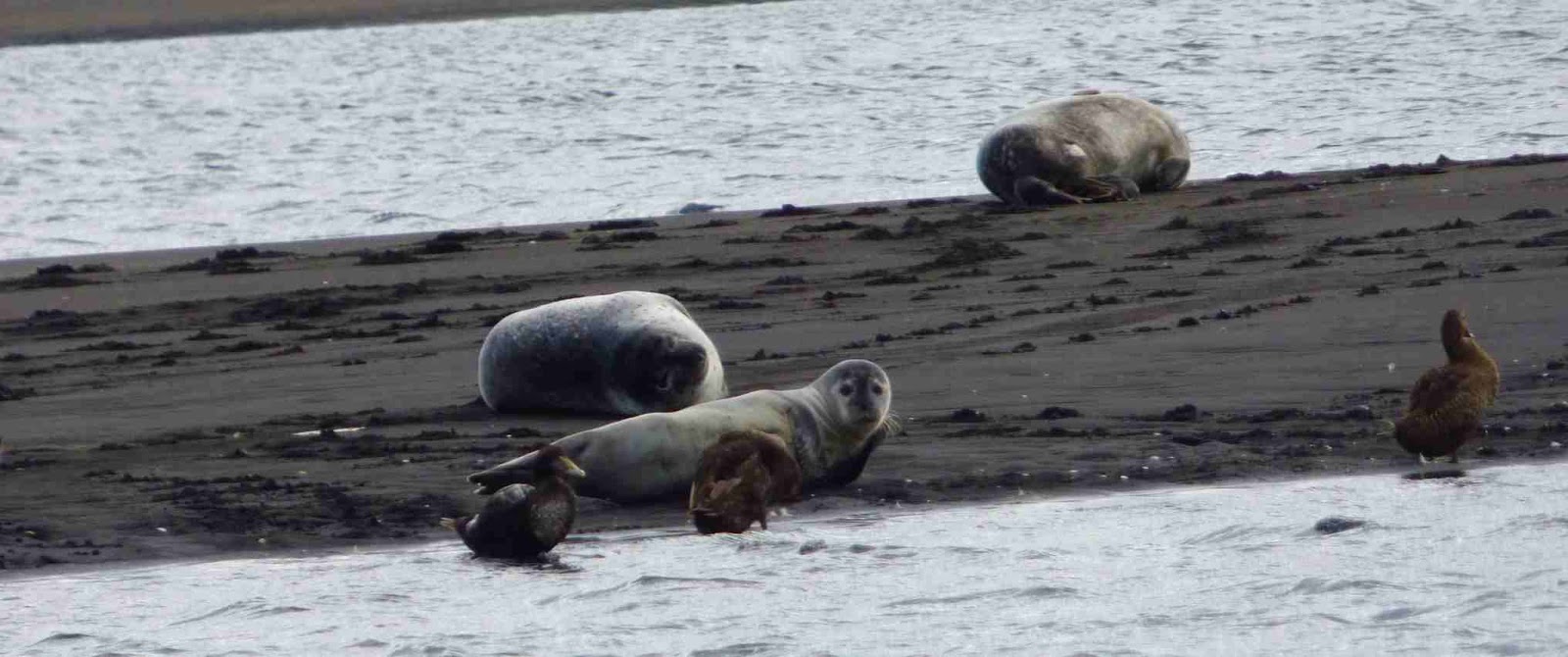
When we walked back, we stopped near
the small island and enjoyed watching the seals on the island and the
several guillemots swimming.
For perspective, that is the island with the seals in the background, zooming in will show the seals and guillemots...
View from the hiking path...
The drive and the first look at
Hvitserkur had not been that impressive but later the waterfall and
the beach and the seals, birds and the sight of Hvitserkur from close
quarters proved worthwhile.
We headed toward Snaefellsnes
Peninsula.
Passing by the rolling mountains and the stony shores, the
first stop was canyon Kolugljufur.
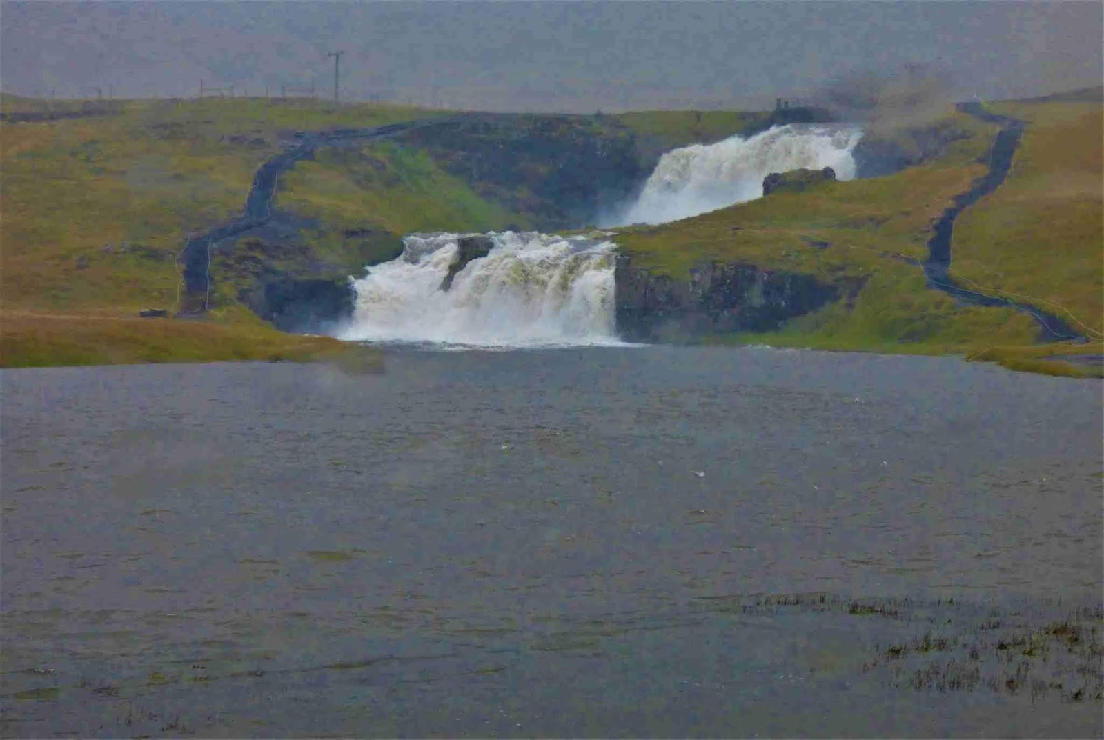
Kolugljúfur:
Kolufossar:
Kolugljúfur is a gorge in the
river Víðidalsá river, a great salmon river running through the
valley of Víðidalur. There are a few
beautiful waterfalls in the gorge, the most impressive one being the
majestic Kolufoss, of course. It is one of many impressive natural
wonders in Víðidalur and Vatnsdalur valleys, in the west part of
the Northern region, often referred to as Húnavatssýsla
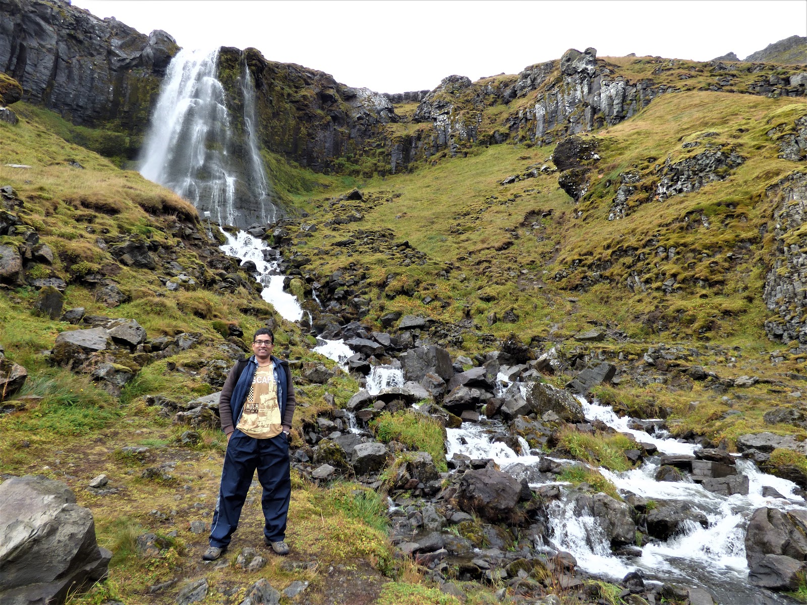
The Kolufossar waterfall flows over the
rugged hill where the streams are diverted into small creeks and they
continue to flow in the gorge. There is a little parking area right
before a bridge. From here you can explore the canyon in both
directions. To the right is the canyon, and to the left, the
waterfall.
In the pic below, we can see the 1st bridge we were on in the previous 3 pics above... so we walked down here after being on that bridge. We had parked there, could have parked here as well.
The canyon is 1 km long, 25 meters deep.
Kolugljúfur derives its name from the giantess Kola, who lived on a ledge in the gorge. After a good night's sleep, she would throw her bare hand into the stream to catch salmon for breakfast that she would eat raw. Sometimes though, she would also throw it into the nearby Koluketill Kettle, a hole in the ground with boiling water. There she would cook her catch for lunch or dinner. Good story, ha?
We walked onward to see the canyon
Snaefellsnes:
We had to head on our way towards
Snaefellsnes on RT 54.
Saw a bunch of people crowding near some horses near the fence on a farm.
The horses seemed OK with the attention, so we also petted them
I had jotted down Grabrok crater and during
our research found that it as quite out of the way and it may be
better to just follow the coastal road. But I forgot about this and
navigated our drive toward Grabrok crater. It is right on Ring Road.
Standing on the rim of the crater, the view from the height of
170-meter was OK. surprising why this sight deserves the lovely steps
built with so much expense. The crater is empty... no lovely lake
like Kerid crater and the views are not mind blowing.
We also had
very heavy winds almost pushing me off the steps!
Anyway stupid waste of time!! Should have just followed the coastal road to Grundarfjordur.
Kirkjufellsfoss:
Weather turned very drizzly and there
was hardly any visibility. We even hit up a bad gravelly road and
some maintenance work was going on. We neared Kirkjufell, one
of the most photographed mountains in Iceland standing 463 meters
above the sea.
 Kirkjufell means Church Mountain as it is
considered to resemble a church.
Kirkjufell means Church Mountain as it is
considered to resemble a church.
There is Kirkjufellsfoss waterfall
nearby. The composition of the two makes an epic scene, the
mountain is actually across the street from the falls. We pulled into
the small parking lot in front of the falls. Walked out in the steady
drizzle and high winds. The drizzle stopped for a while.
We took some
pics and walked back to he car when drizzle started again. We did not go
to the other side of the falls for the classic pic of the falls wit
the mountain, like in this signboard at the place,
 because frankly it was foggy and did not look that
special.
because frankly it was foggy and did not look that
special.
Grundarfjörður HI Hostel:
Reached our accommodation
Grundarfjörður HI hostel. Checked in at the bright red house and
went to our private colorful room.
Wanted to head out to explore
the village, but the rain had picked up. We settled in for the day.
Had some food.
The rain lashed against the window panes and the wind
howled so loud thru the night. We are sound sleepers but even we got
up a couple of times in the night because of the noise the wind made!
Thought the rain and wind will die down
by morning and slept off. Oh, how wrong we were!
Report of day 9 is here: