DAY 4 Monday Sep 2, 2019:
Dyrholaey:
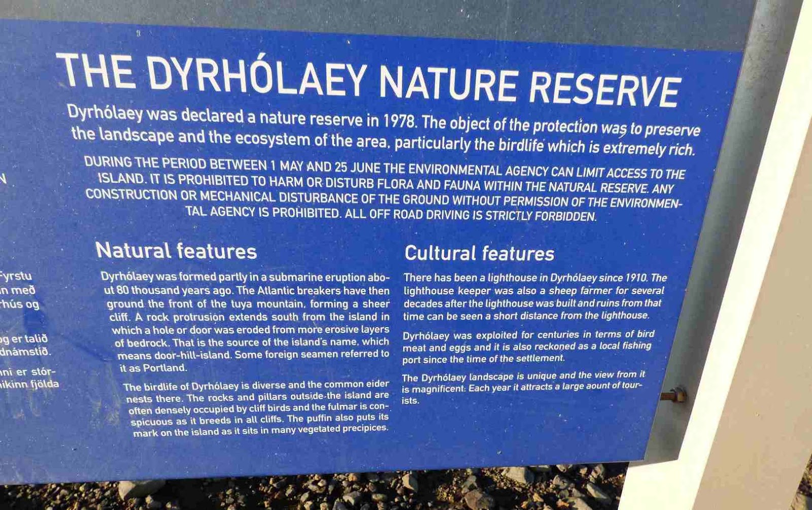
Our first stop was Dyrholaey, a
promontory standing 120 meters high over the ocean. This is a summer
breeding paradise for birdlife including the Puffins. On the top,
there is a white lighthouse. From there we can see an unbroken view
of glaciers, black sand beach with silver tides, and an enormous lava
arch rising in the ocean.
We can go to the lighthouse on the top,
but then we'll need a 4WD, so we went to the lower parking,
The drive itself as beautiful


On this
spot, we had great views over the black beach, a couple of stone
formations and even some birds... missed the puffins nesting (which can be seen only May-August).


We drove on


Reynisfjara Black Sand Beach:
Then we went on to the
famous Reynisfjara Black Sand Beach. The black sand was formed
by the eroded volcanic rocks. Columns of basalt dramatically stand
on the beach forming a wall like a surreal gigantic sculpture.


Need to keep an eye on the ocean at all
times since there are sneaker waves that hit suddenly and have
claimed peoples life recently.
To the right we can see the stunning
Dyrhólaey Peninsula with an arch and rocks jutting into the sea.
Vik:
We then drove on to Vik.


Vik is a small
fishing village in front of the ocean with stellar sea views. We saw
the landmark red-roofed church that sits on the hill overlooking this
area.


We bought some provisions at the supermarket, the mall has very clean free restrooms (Dyrholaey and Reynisfjara both have pay restrooms... 200 ISK). We then drove on.
 Fjadrargljufur canyon:

Next stop for the day was
the Fjadrargljufur canyon.

Fjaðrárgljúfur is a massive canyon,
about 100 meters deep and about 2 kilometres long. The canyon has
sheer walls, and is serpentine and narrow. The bedrock in
Fjaðrárgljúfur is mostly palagonite from cold periods of the Ice
Age and is thought to be about two million years old.
The river Fjaðrá has its source in
the mountain Geirlandshraun and falls off the heath edge in this
canyon until it makes it down into Skaftá river. Fjaðrá has
changed a lot in the course of time. Today Fjaðrá is often rather
low in water and therefore hikers can safely choose to walk inside
the canyon.


However, wading is necessary fairly often. Deep in the
canyon there are waterfalls so one needs to walk the same way back.
Most people choose to walk along a walking path up on the canyon's
edge while simultaneously enjoying the view above the canyon.
At Fjadrargljufur there are two areas
to park. One side is on all paved roads, and takes you to the side
furthest from the waterfall, and is steeper hike up to the canyon.
The other entrance is on a dirt/gravel road to a parking spot nearest
to the waterfall side of the canyon. From there it is a 5 minute walk
or so down to the canyon.
We took the paved road and parked. The
canyon snakes up towards a waterfall. The path is well prepared with
plastic grid boards/net matting and railings. There are 3 stops
(viewing platforms) on the about 1 km long track (single way). Two
quite early on the track (but uphill) and the third at the end of the
canyon. Saw 2 people skid and fall … the loose gravel is slippery
in places.


After seeing the water fall we made our way back.

[From the car park, if you instead go down a bit to the bridge, you can creep under the bridge and walk around the river at the base of the canyon . It's vertical, but well-designed for anyone of any hiking abilities.]
We drove on.


Saw a pretty water fall,
pulled up and had our picnic lunch there. Near the bubbling brook.


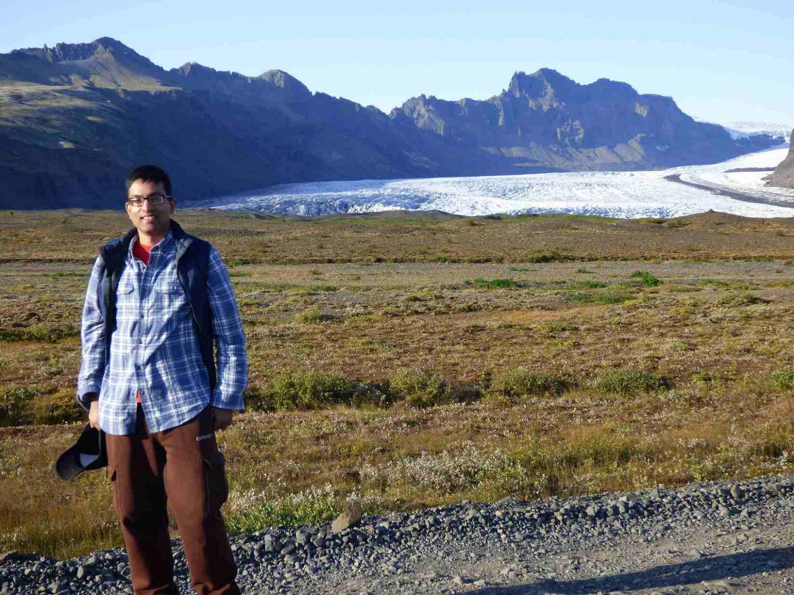
We were driving to the Skaftafell
national park next. Along the drive there, had multiple pull outs to
stop at and take pictures of the glacier and snow capped mountains.


Skaftafell National Park:
Next stop was Skaftafell National Park.
Some great trails begin at
Skaftafell Visitor Centre:
Skaftafellsjökull - an easy
3.7 km (2.3 mi) hike with impressive views of Skaftafellsjökull
glacier.
Sjónarnípa - this 6.4 km
(4 mi) hike includes some challenging sections.
Svartifoss and Sjónarnípa
- a 7.4 km (4.6 mi) hike with some challenging sections.
Bæjarstaðarskógur - a
challenging 15.8 km (9.8 mi) circular hike through sensational
ravines and the beautiful birch woods at Bæjarstaðarskógur. Not
fully way-marked.
Kristínartindar - a
difficult 17.9 km (11.12 mi) circular hike to the top of the
Kristínartindar ridge. This trail is usually closed from spring
through June due to thawing ice.
Morsárjökull - a
challenging 20.9 km (13 mi) hike to the glacial lake at the
Morsárjökull glacier.
Kjós - a challenging 29.8
km (18 mi) hike - the part of the trail which leads up from the
birch forests at Bærjarstaðarskógur is not well-defined.
There are 2 popular hikes... first is
to Skaftafell Glacier head. the 2nd to Svartifoss Waterfall. If you go
to the right of the visitor center you hike to the glacier, if you go
to the left, you hike the mountains/waterfalls. Both are worth doing.
The 2nd is more uphill but the views of surrounding area and
waterfall are stunning. Or, if you are and advanced hiker you
can do a loop that goes to both
We decided to do the Svartifoss hike;
it is listed as easy because the trail is carpeted with large
plastic mesh panels, which prevents erosion and makes the path stable.. but there is a good steep incline to get up to
it. Not easy for anyone out of shape.
Also, as you are walking
down to the base of the waterfall the path changes and becomes a rough trail than the carefully maintained path you had till
that point. Very steep, lots of mud and big rocks. Comes as a
surprise after the well maintained path!
Svartifoss means Black
Falls. Stórilækur flowing from Vatnjökull glacier, not far the
mountain peaks of Kristínartindar, feeds Svartifoss.
The waterfall
tumbles down 20 metres (80ft) over a cliff which is bordered on both
sides by tall black basalt columns, resembling pipes of a giant
organ, Columns like these form in a lava flow that cools very
slowly, forming these hexagonal shapes The waterfall is in a lush
green area where birch and rowan trees grow well, the dramatic
mountains and glacial landscapes of Vatnajökull National Park
surround the area.
The hike to Svartifoss,
starting from the Visitor Centre in Skaftafell, is about 2 kilometres
(one way). On the way to Svartifoss you come across three other
waterfalls; Þjofafoss (Thieves’ Fall), Hundafoss (Dogs’ Fall)
and Magnusarfoss (the Falls of Magnus).


Once you get to Svartifoss
there is a small bridge close to the waterfall that allows you to get
closer.


On the bridge...


Decided not to do the loop as time was
creeping by. Returned to the trailhead the same way we went.


Svínafellsjökull View Point:
Resumed our drive.

Rattled along a 2 km
gravel road after a short turn off the ring road, very slowly &
carefully avoiding major pits


to reach Svínafellsjökull View
Point.

Svínafellsjökull pig mountain glacier’ is approx. is
1,000 years old. Sitting in a dreamy landscape, with its deep,
impressive crevasses and formations Svínafellsjökull has been a
shooting location for many Hollywood movies and TV shows like Batman
begins, Interstellar and The Game of Thrones.


Stunning glacier lake and glacier
itself.


There was another stop at a stunning glacier


Jökulsárlón:
Jökulsárlón
'Glacier's-River-Lagoon' was our next stop, and it’s the crown
jewel of the day. glacier lagoon filled with icebergs. its stunning
beauty.


Our cruise in the lagoon was scheduled for the next day. So
we just enjoyed the lagoon in the evening sunset before we moved to
our accommodation... private room at the HI Hostel, Hofn.
Vagnsstadir HI Hostel, Hofn:


It would be a short drive of 20 min to
the lagoon the next day for the tour.
Report of day 5 is here:
No comments:
Post a Comment