DAY 6 Wednesday Sep 4, 2019:
We had to get the car key battery
changed, gas stations open only by 9 am.
Backtracked again because we so wanted
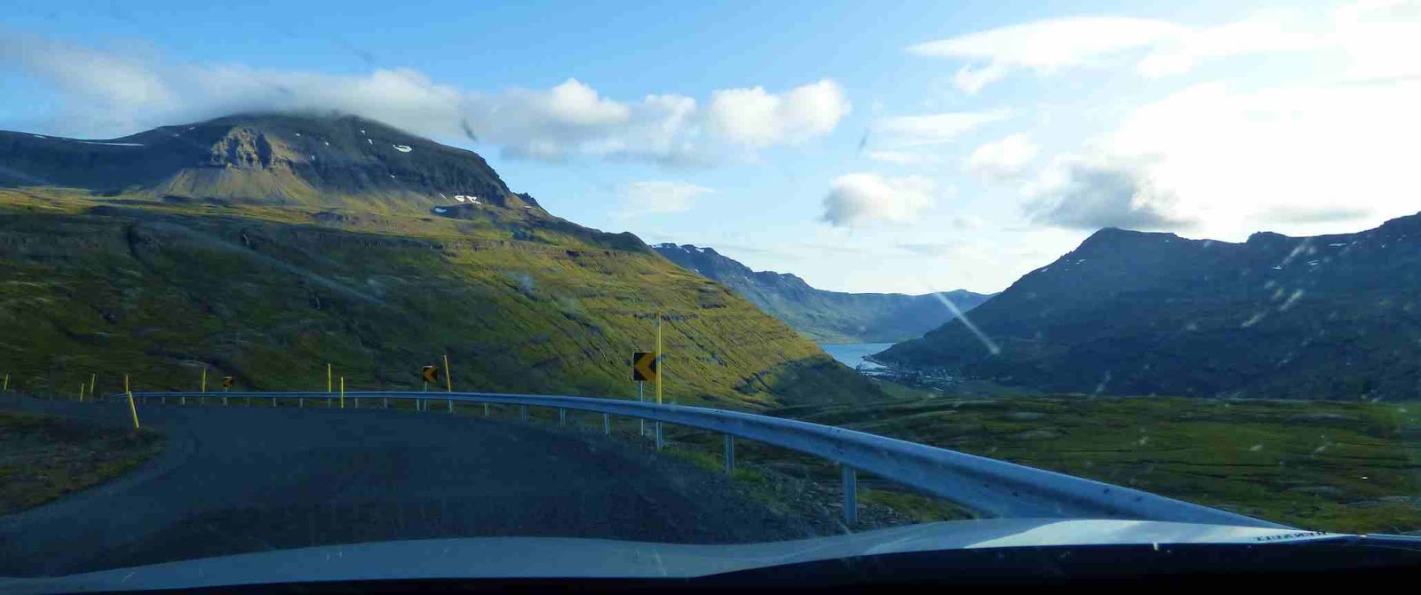
to see the village of Seydisfjordur with its rainbow road. Road 93
was lovely; runs over the plateau and runs up to an altitude of more than 600 meters with beautiful views .


Gufufoss:
Very nice waterfall along the road down
to Seydsifjordur. It is well worth a stop. The name means "Steam waterfall" derived from the mist that often accompanies the area. It is one of many(25)
waterfalls in the river Fjarðará.


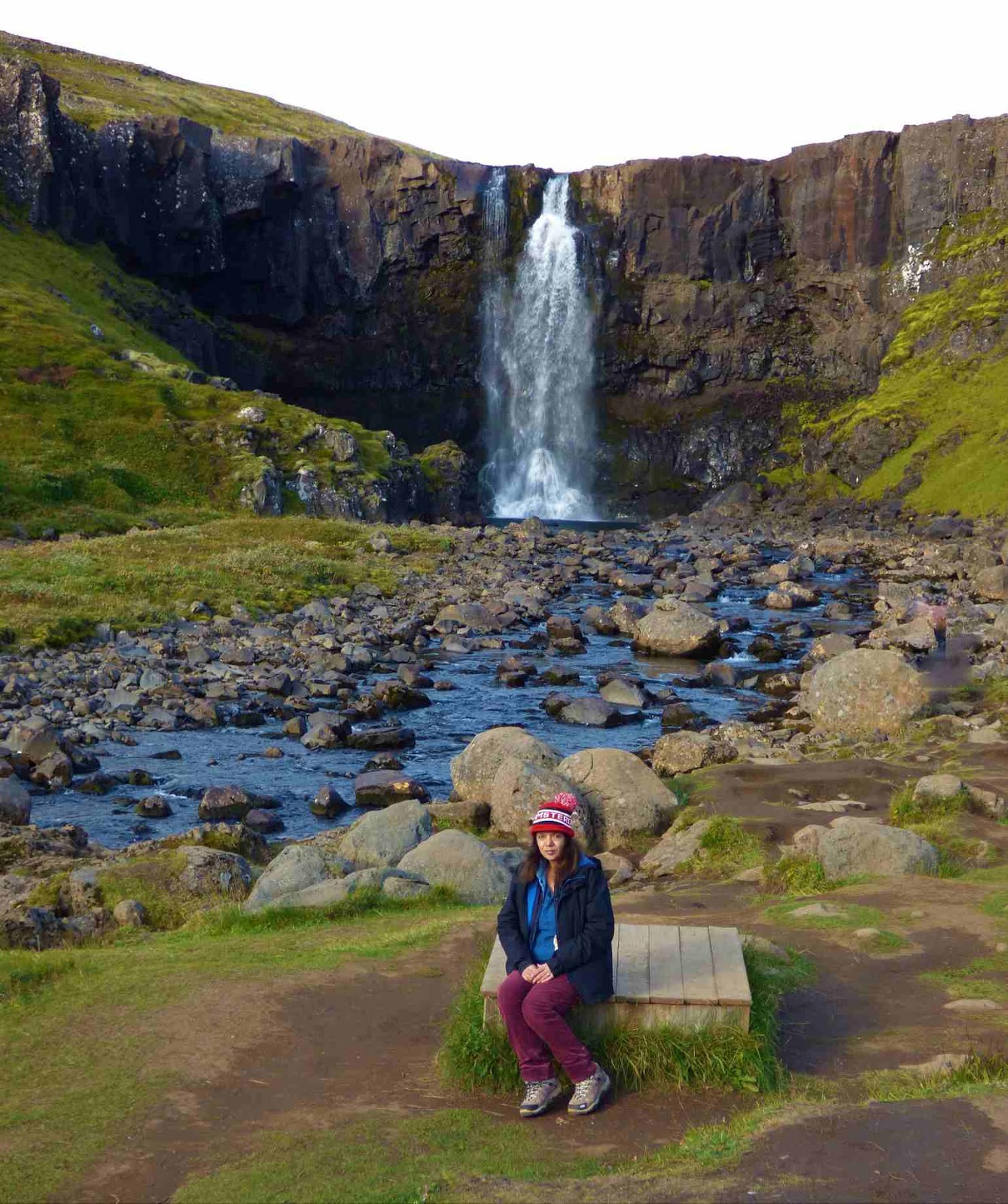
The origin of the river lies at the
Fjarðarheiði plateau, between Seyðisfjörður and Egilsstaðir.
There is a trail nearby to see many
more waterfalls.


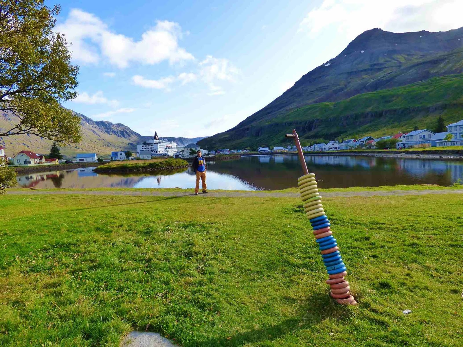
Seyðisfjörður :
Very picturesque.

Saw the iconic rainbow road leading to the church.


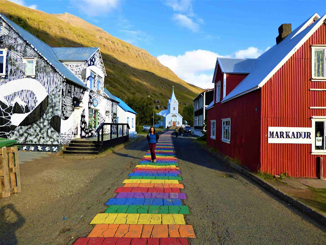

There are great views ... a nice lake with the reflections of the multi-colored houses and snow capped mountains.

Saw the iconic rainbow road leading to the church.


There are great views ... a nice lake with the reflections of the multi-colored houses and snow capped mountains.


Retraced our way back to Egilsstadir.
wasted time in 2 gas stations and had to go to a special auto parts
shop for replacement. Had read a review saying road 94 going north to
puffin cliffs is a beautiful drive but we had a long day ahead of us.
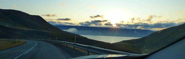
Started driving west toward Akureyri,
hoping to cover some highlights of the DIAMOND CIRCLE.
Rjukandi Waterfall:
This huge waterfall can be viewed after
walking a short trail right beside the highway 1 ring road. It is
between Egilsstadir and Akureyri. It is well marked and hard to
miss.
on the way to Dettifoss


DIAMOND CIRCLE:
We then headed to the part of Iceland
which people often refer to as the Diamond Circle. magnificent
circuit of about 260 km in the Northeast of Iceland, which
includes some stunning sights and scenic landscapes.
Húsavík is the main town and a
convenient starting and ending point of the Diamond Circle. It is
worldwide famous for its great whale-watching. Other
highlights of the circuit: the horseshoe-shaped canyon
of Ásbyrgi; the valley of Vesturdalur with the
bizarre rock formations of Hljóðaklettar (Echo rocks); the mighty
Dettifoss waterfall; the volcanic fields of Krafla, the
geothermal area of Hverir; lake Mývatn and its
surrounding nature bath of Jarðböðin and lava field
of Dimmuborgir; the turf farm Grenjaðarstaður, the
elegant Goðafoss waterfall. Some of these sites are part of the
Vatnajökull National Park, which has been approved as UNESCO world
heritage site in 2019.
But the Diamond Circle is even more.
off the beaten track: the sparkling Skjálfandi bay to the
beautiful Tjörnes peninsula, from the east side with the lush
valley of Hólmatungur to the less known location around Mývatn such
as the dark Hverfjall and the turquoise pool of Grjótagjá,
etc.
Anyway, we had very little time at our
disposal and planned to hit up only major sights.
Our target was the Dettifoss. We
entered the Vatnajökull National Park.
DETTIFOSS:
The falls are in a mighty glacial river
that originates from glacier Vatnajokull. They are 100 metres (330
ft) wide and have a drop of 45 metres (150 ft) down to the
Jokulsargljufur canyon. It is the largest waterfall in Europe in terms of volume
discharge, having an average water flow of 193 m3/s.


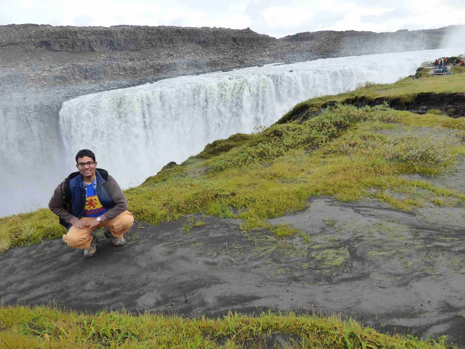


GPS leads us to the East side, Road
864 which is the gravel & dusty road.
The choice here is to pick which side
you want to see it from. West or east. We visited on the west side.
[[This was the comparison we had got from our research.:
You can see the waterfall both from the front as well as the side. The east side is more only from the side You get an elevated close up position which is good for panoramas.
The east side allows you to walk all the
way to the edge but on the same level.
There are some platforms and ropes that provides some sort of good ground to walk on and some sort of security. East side had nothing like this.
It's a short walk from the parking to the fall, but east side is a bit shorter.
If you go further into the national park, west side gets faster to the sights.
If you only want to see Dettifoss,
then go there on the West side as you save more time driving north on
the paved road. Also, the path to Dettifoss on the south side ramps
down but on the north side, you have to take a few flights of stairs
if you want to get really close to the falls.]]
SELFOSS:
Moving from Dettifoss, we enjoyed
Selfoss also.
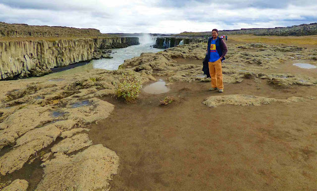


Selfoss is only 600 m away. We did not see the horseshoe fall from the west side, but got a better sideways view of the fall. East side will see the horseshoe and get a frontal view of this fall. The cascading waters on this horse shoe shaped fall extends further on the west side, which can be viewed much better from the east side of the fall as you are viewing from across the river. Standing on the west side, it is right below us, so there is no way to see it.


Selfoss is only 600 m away. We did not see the horseshoe fall from the west side, but got a better sideways view of the fall. East side will see the horseshoe and get a frontal view of this fall. The cascading waters on this horse shoe shaped fall extends further on the west side, which can be viewed much better from the east side of the fall as you are viewing from across the river. Standing on the west side, it is right below us, so there is no way to see it.
The walk to Selfoss is a little easier
on the west side though as there is a proper path, but the walk is a
bit more difficult on the east side as you have to climb over
boulders at some point. All are marked with yellow markers.
In the Vatnajökull National Park, We
originally planned to continue on to other natural wonders like the
Jökulsárgljúfur glacial canyon, Vesturdalur valley,
Hljóðaklettar’s echoing cliffs and the towering, crescent-shaped
Ásbyrgi canyon. [The Vikings believed the Asbyrgi Gorge was
formed when the god Odinn's horse, Sleipnir had left an enormous hoof
print with one of his eight legs. ] then we planned to turn back as a
loop on the east side seeing Dettifoss etc from that side also, but
the gravel road was not pleasant to negotiate and we decided to turn
back and get out of the park the same way we had entered... by paved
road 862
This area has landscapes with
remarkable volcanic and geothermal features.
Hverir/Namjafjall geothermal area:


Our first Myvatan stop was
at Hverir/Namjafjall geothermal area. It is a pretty large area
with various mud pots, steam vents, and an area where you can hike up
as well. From 1563 the Danish produced naval gunpowder from
Namaskard, due to warfare with the Swedes.The name Namafjall (Mine
Hills) is from sulfur production in the geothermal area at Namaskard.
At 1 km depth, the temperature is over
200°C, and magma has been found just two kilometers below the
surface of Krafla. The active solfatara is a kind of mud with
geothermal activity, which has the characteristic odor of rotten eggs
due to sulfur compounds
After this we saw the diversion for
Krafla. Decided not to take it. Skipped lake Myvatn too. Regret it
now. In our defense we had a long drive and had to reach our
accommodation before 9PM.


Goðafoss:
Goðafoss waterfall cascade that flows
over a semicircle of jagged cliffs. This elegant waterfall with
astonishing symmetrical cascade is 12-meter high and 30-meter wide.


The cascade’s name means “waterfall of the gods” and is a crucial turning point in Iceland’s history. This is the spot where in the year 1000 or so, religious leader Þorgeir Ljósvetningagoði threw the pagan idols of his Norse faith over the waterfall’s edge. This served as an overt gesture and a powerful symbol of his conversion to Christianity. The country embraced the new monotheistic belief system as its official religion.


The cascade’s name means “waterfall of the gods” and is a crucial turning point in Iceland’s history. This is the spot where in the year 1000 or so, religious leader Þorgeir Ljósvetningagoði threw the pagan idols of his Norse faith over the waterfall’s edge. This served as an overt gesture and a powerful symbol of his conversion to Christianity. The country embraced the new monotheistic belief system as its official religion.


Akureyri H.I. Hostel:
We drove on as the sun was setting and spreading its golden touch across the sky.


reached our Akureyri H.I. Hostel;

we had a private ensuite room. The washbasin and shower were quite tiny but we made it work.


reached our Akureyri H.I. Hostel;

we had a private ensuite room. The washbasin and shower were quite tiny but we made it work.


Report on day 7 is here:
No comments:
Post a Comment