June 27, 2015 :
Bergen :
Summary: Rental car pickup from airport
, cable car ride to Floyen, stay on the foothills of the scenic Montana Ulrik
with free parking to boot!
Rental car pickup from airport:
After reaching the Bergen
train station, we went to the bus station in Bergen
and took the airport express to the airport. Yes, with our bags, because that was the only way we’ll be able to make the car rental counter in time.
We had to go to the airport for picking our rental car
because the rental at the city center was closed early as it was Saturday and
on Sunday, they opened only at 12 noon .
So we hired a car from the airport which was open till 5 pm and returned it there when we took our flight to
Leknes 3 days later.
You can see how tough the logistics are…
You can see how tough the logistics are…
Picked up our automatic rental car at the Bergen
airport.
The Seven Mountains Bergen .
The mountain group includes
Ulriken (the highest), Fløyen. Which mountains belong to the group is
unclear, due to the fact that several of the mountains are part of the same
mountain massif.
No matter what the name, the surrounding hills make the city
look pretty scenic.
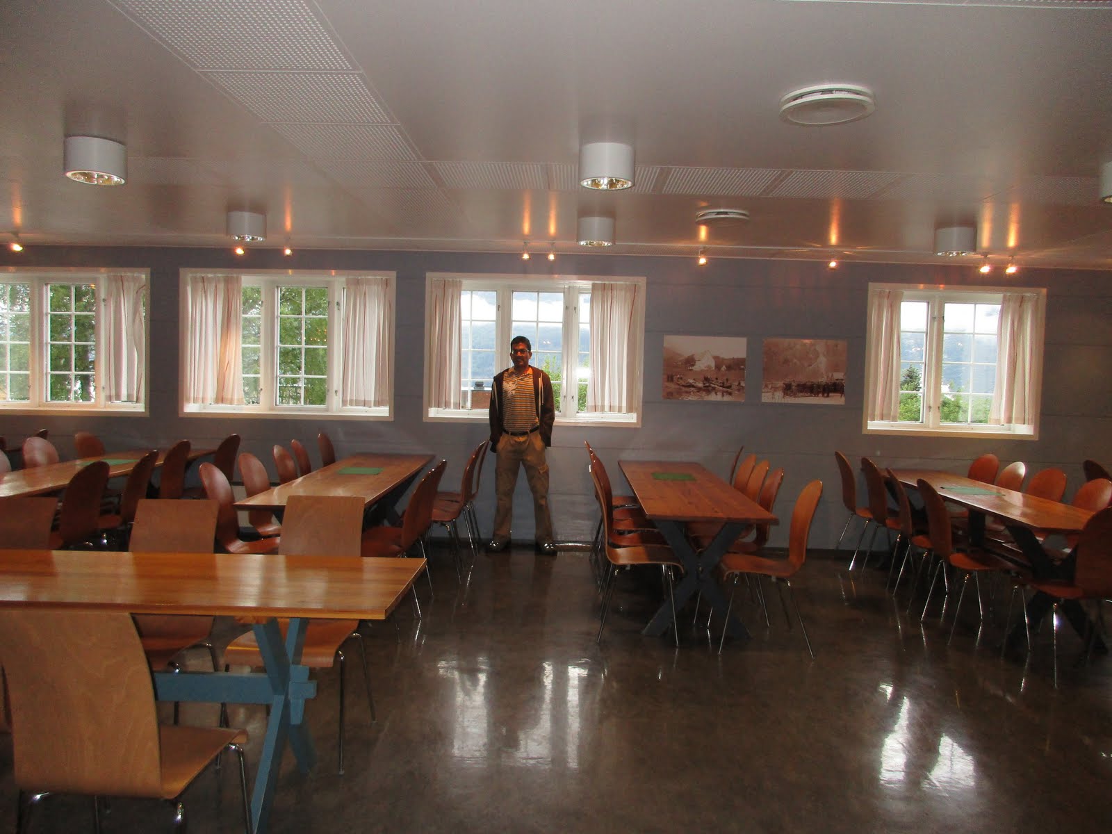
Vandrerhjem Montana:
Our google map with a route from airport to our hotel proved
useless as a road was closed for repair… thankfully the GPS suggested an
alternate route and we reached our hostel, Vandrerhjem Montana at the foot of
mount Ulriken.... lovely green surroundings and free parking...in Bergen city
center hotels, parking is pretty expensive. We were pleased with the spacious grounds,
the scenic view and the private room with ensuite bathroom at the hostel.
Perfect in every way.

Checking in...

Communal kitchen...

Bunk beds...

View from our room window...Mount Ulrik

In Norway
we stayed in 2 hostels , both in private room with ensuite bathroom and both
were great value for money in a very expensive country. The linen we carried
came in handy here as well as they are charged separately.
After check-in, we drove down to Bergen
city center and parked at the railway station parking. (parking not easily
available in city, so need to plan ahead where we can park easily.)


Used debit card with pin in the garage and other such places
which needed a code to be punched in ...
(US credit cards don't have chip and pin which European
organizations use. If there is a person at the counter they accept signature
with US credit cards).
C able car ride to Floyen:
We walked to the foot of Floyen, one of the tall hills
surrounding the city, got to the cable
station (Floibanen... cable car station; if I had not known that might have
walked on past that building clueless!)

Took the cable up.. . Only 6 minutes
from the city, and we have this breathtaking view and hiking opportunities


Had a ride up at 9.30 pm, watched the sun sink in the
horizon over the city and then came down at 10 pm. Bergen
city view from top of hill Floyen was great..
It might have been fun to do some hike but we had no time as we were on to our Hardanger fjord drive the next day.
It might have been fun to do some hike but we had no time as we were on to our Hardanger fjord drive the next day.
We walked back, picked up our car from the garage, paid just
40 krones for 1 hour parking and drove back to our hotel.
June 28, 2015 :
Hardanger tourist route drive
We checked out early from our hotel. We took just one small
bag for our overnight stay in Lofthus and kept 2 main bags in the hotel as we
were coming back to Bergen . We
wanted to drive through the Hardanger fjord area and enjoy the scenic views and
the several water falls on the way. This is one of the famous tourist routes of
Norway .
Hardanger is pronounced...har dan ghi yeh ... the letter g as in give... so the pronunciation should NOT be the English word 'danger'. Norwegians are such nice people. When we butchered some words unintentionally, there was no reaction... some times just an amused glint in the eye and an unobtrusive correct pronunciation in their reply!
The Hardangerfjord is the fourth longest fjord in
the world, and the second longest fjord in Norway .
It is located in Hordaland county in the Hardanger region. The
fjord stretches 179 kilometres (111 mi) from the Atlantic
Ocean into the mountainous interior of Norway
along the Hardangervidda plateau.
Day started off foggy with slight drizzle and we were a little sad our day was not clear..
GPS was set to Norheimsund visiting Fossenbratte and
Steinsdalsfossen on the way. (fossen is the Norwegian word for water falls). There
were nice views through the mild drizzle.
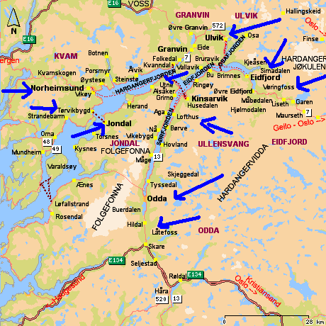
Fossenbratte:
Fossenbratte was our first lookout. Fossenbratte (Steep
falls… (pronounced "BRAH-tuh" meaning "steep")) (also
called Bridal Veil) is a waterfall in Eikedalselva bottom of Eikedalen in
Samnanger .
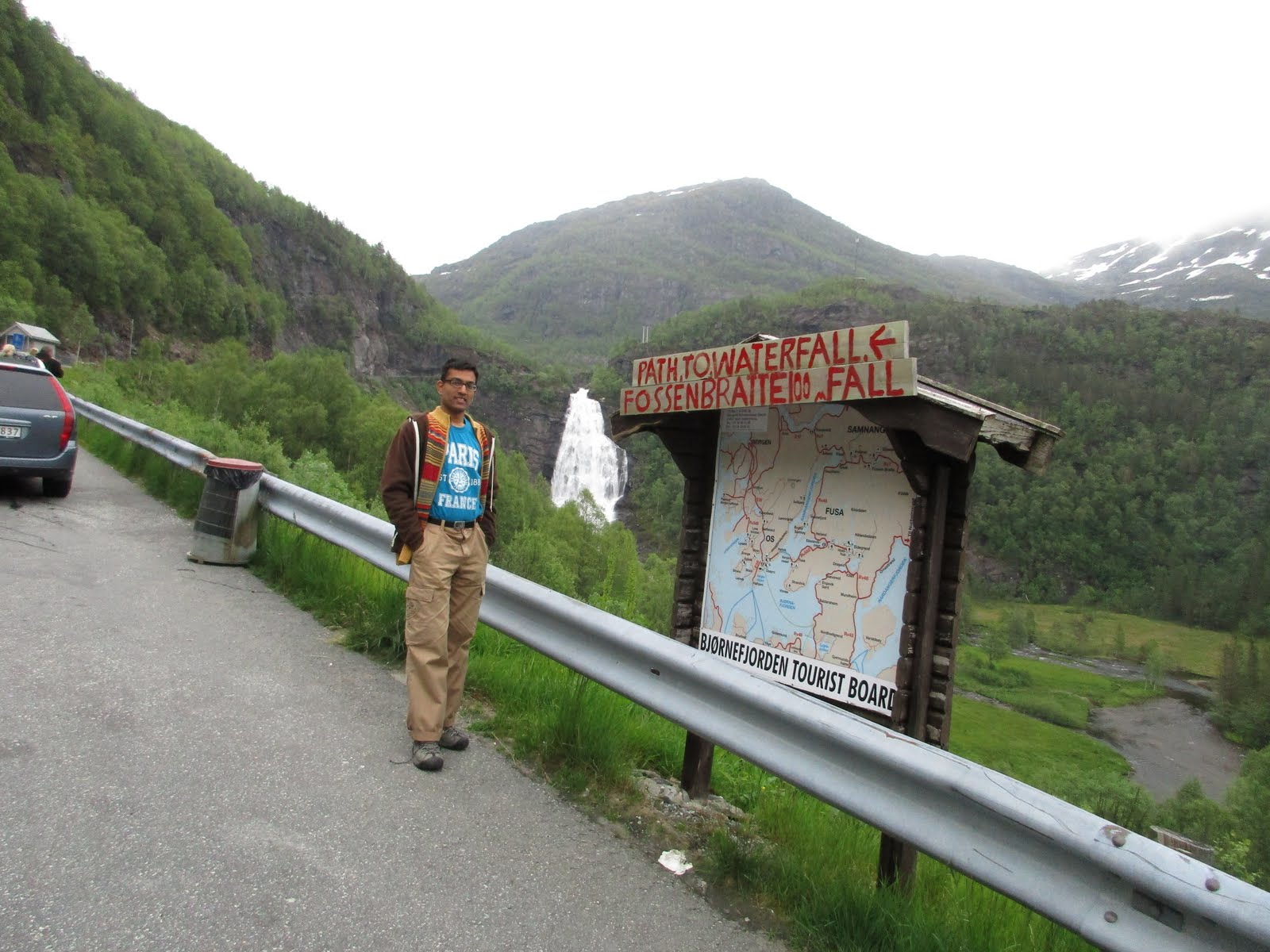
During the Second World War this valley was the scene of
fighting between Germans and the Norwegian resistance. It was a blocking
position above the bend in the road where the waterfall flows out.
A French couple, René Laigle (28 years) and Ginette Laigle
(24 years) were on honeymoon when they ran off the road on 13 July 1951 . They drove out on top at the
falls and both were killed. There's a memorial plaque at the bottom of the
valley for them.
A common misconception is that the incident got waterfall
nicknamed "Bridal Veil...Brudesløret)".
We saw a signboard for the falls, parked the car and walked
a bit for a pic of the water fall.

It was an easy walk. Thankfully the drizzle
had stopped and we enjoyed the view.

There are clean toilets in car park at regular intervals on this
tourist route.

We knew another viewing point was coming up before entering
the tunnel... in fact we had been alert after crossing the previous tunnel
Liarostunnelen; we did not want to miss the chance to hike. We parked at the
big sign.
From there, there is an easy gravel path to the bottom of
the waterfall. We hiked to the falls, also saw Memorial stone for the young
honeymooners who lost their life here.

It does look fanned out like a Bridal
veil; it's 80m high;

we enjoyed the views sitting on the benches.


The path we had gone through earlier seen here... Looks
steep but was easy to negotiate.
The whole place is very scenic… not visible in the pictures!
Steinsdalsfossen:


Lovely trolls...

The waterfall is located about 2 km (1.2 mi) west of the
large village of Norheimsund
From the parking lot, a path goes along the waterfall, up a hill, and behind it where visitors can walk dryshod "into" the rumbling water. Behind the waterfall...the jutting rock that makes this walk possible. Now to the platform at the side of the falls...


Bought some souvenirs (surprisingly reasonably priced for a place in such a prominent spot)
and chocobars.


Drove on to Norheimsund and then took the road to Torvikbygd
along the fjord

Car ferry to Jondal:
We then drove on to Torvikbygd , took the car ferry to Jondal. There was a long line of cars at the pier and we took our place at the tail end as the ferry was coming in. waiting our turn at the car ferry at Torvikbygd... we had earlier checked the car ferry timings for the weekend and ensured we'll be in time.
There was a huge line. we got in last. The ferry was full.

It was a short but scenic ride with hills and greenery and shimmering water all round...


We drove out of the ferry and stopped for a lunch break at
Jondal.


Utne and Odda:
We resumed our drive and our GPS was not recognizing the
names Utne etc we were trying to feed in. By mistake I put in Odda as that was
our ultimate destination on this leg. We reached Odda and realized our GPS has
taken us thru 2 long tunnels under Buerbreen, 10km and 11km long.
Our plan had been to drive from Jondal to Utne and then down
to Odda hugging the fjord all the way… we had skipped the scenic fjord drive
but taken the fast route to Odda.
Now we decided to retrace our way to Utne and the fjord
views were great...


all through we were much below the speed limit enjoying the
views and pulling up frequently. Decided
to turn back just before reaching Utne as time was slipping by.


Used bus stops to pull up and let faster vehicles
pass;


Kro means tavern in Norwegian... of course the fork/spoon sign is universal. Note how the tunnel is set into the hill...


Låtefoss:
From Utne onward to Odda... Loved the Låtefoss (pronounced la ch eh and means "loud"!). Låtefossen or Låtefoss is a famous twin waterfall close to Route 13 in Oddadalen valley.
The 165-metre (541 ft) tall waterfall is unique ... it
consists of two separate streams flowing down from the lake Lotevatnet, and as
they fall, they join together in the middle of the waterfall, just before going
under the Norwegian National Road 13, making for a spectacular (and wet) view
as one drives over the old, stone, six-arched bridge.


We drove past the water falls twice over enjoying the unique
experience.


Hardanger Vandrerhjem:
Then we turned back and drove on to our lodging for the
night at Hardanger Vandrerhjem at Hordatun, Lofthus.
Lovely fjord views all the way.

Always fascinated by such houses on the hill side with a steep ramp entrance...

Our hostel was located in
the midst of orchards with apple, plum and cherry trees.


Awesome fjord view from the grounds...


This is where we checked in...
Comfy beds..big wardrobe in our room


Orchard and waterfall view from window...

Communal kitchen was great...


This is the lounge where I waited when our food cooked next door...

Dining room adjoining the kitchen...

We had left our big bags at Montana Vandrerhjem Bergen and
carried only 2 small bags. Vandrerhjem means hostel in Norwegian.
Lovely breakfast spread included in the room rent... plenty of options for us vegetarians
also.


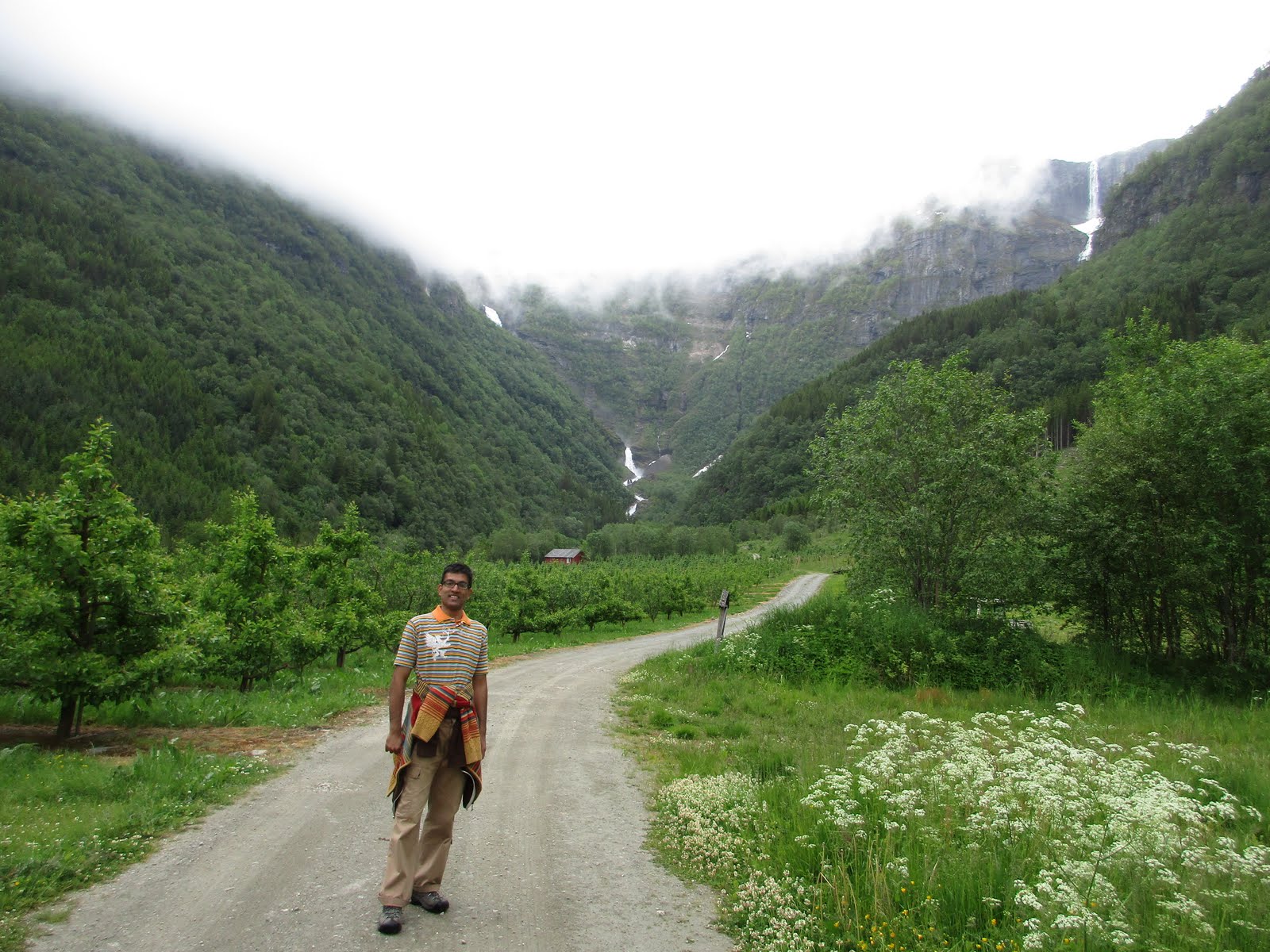
Fruit trail:
After breakfast, we started on our fruit trail hike.


The whole area of
Lofthus is fruit country and it produces more than 50% of the fruits in Norway .
What we get to see depends on the season… the apple blossom season in spring is
supposed to be spectacular.


Fruits coming up in the apple tree...

Map of the fruit trail... with the black dot showing where
we are.

Some facts about fruit blossom in Hardanger:
The blossom lasts about four weeks. The time of blossom
depends entirely on the temperature during spring. First cherries and plums
blossom, then follow the pear and apple blossoms. There is usually blossom
around the date of 15th May.We know more about when the blossom will take place
in the second half of April
There were nice houses and flowers dotting the trail.


Oh...
our little mermaid has followed us from Copenhagen .

Drove on the fruit trail as we wanted to hike the river side trail to the
falls...
W aterfall hike:
Parked the car and started on
our waterfall hike along the river...

2 waterfalls snaking their way down the
hills. We only did the hike toward the left waterfall...
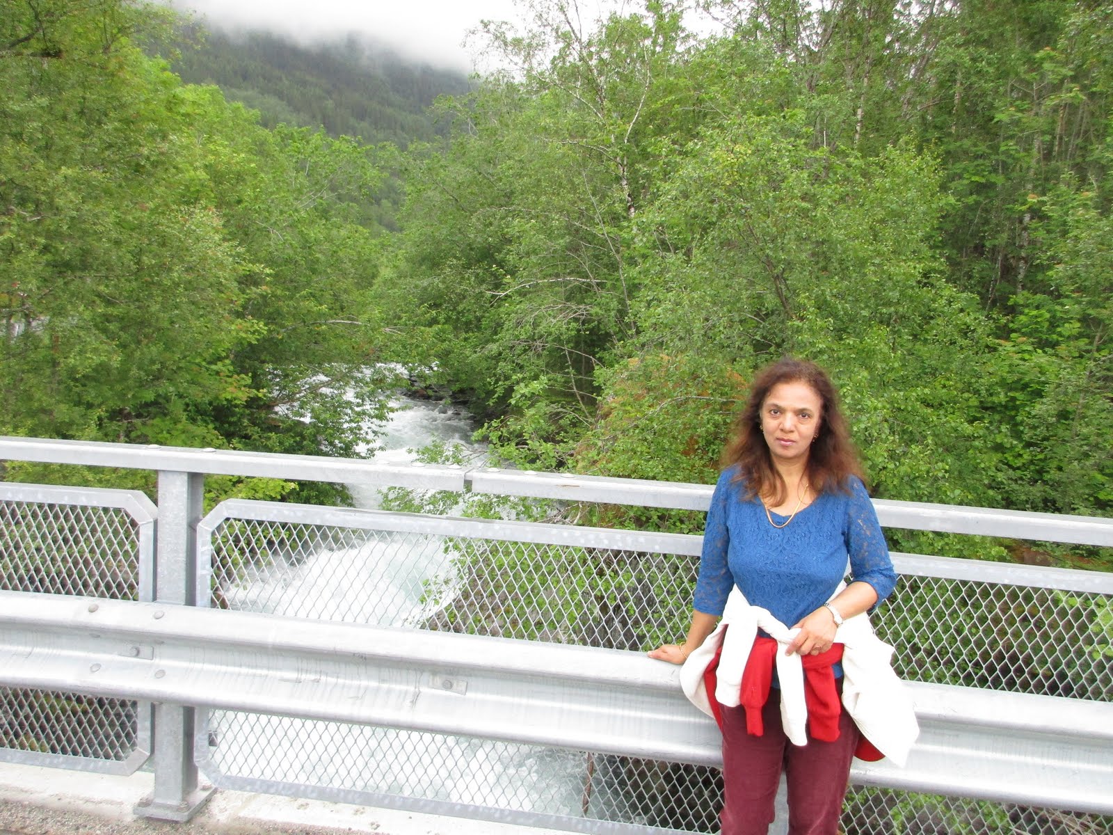
Gushing stream...river
Opo. yay...got to the waterfall

Mmm... a little rest after the 2km walk ...

That looks precarious but was NOT.

On the bridge...

Wild flowers dotting the way.


Our trail Map black dot marks our position on the red fruit trail but we went on the yellow waterfall trail above.

Eidfjord:
We started off on our fjord drive at 11am after our fruit trail/waterfall hike
We drove on to Eidfjord, Mabodalen and Vøringfossen.
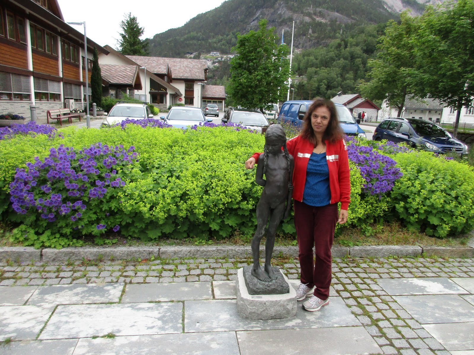
We reached the lovely village of Eidfjord...

Eidfjord is situated at the end of the Eidfjorden, an
inner branch of the large Hardangerfjorden. The village
of Eidfjord


We wanted to drive up to the famous Kjeåsen mountain farm and needed confirmation from the Tourist Info office that the road was open.
As can be assumed from the cruise ships in the pictures, the town was crowded with the cruise people and the TI office had long lines. We decided to just enjoy the pretty square, use the rest room and then leave.


This is the Tourist train in Norwegian flag colors...


Vøringfossen:
We reached the famous waterfalls Vøringfossen...
The name Vøringfossen
(Old Norse Vyrðingr) is derived from the verb vyrða (English: esteem,
revere). It has a total drop of 182 meters, and a major drop of 163 meters.
Next to the car park we followed the left and right walking
trail to check out the views close to the edge of the cliff. There is an iconic
hotel Fossli Hotel from where the view is better. They are in the process of
improving the viewing stations and building a trail and a bridge to link the
hotel viewing area with the rest stop viewing area near the highway. Expected
completion by 2020.
Vøringfossen was the only miss shrouded in dense fog, with
just short windows of the fog lifting for peeks. A lady with a kid wanted us to
take pics of her and kid and by the time we did so, the fog had again descended
and we could not get a picture.


We had our lunch there in the car and waited for the clouds
to lift but no luck. There was no point driving up to the hotel because at
higher elevation the fog was bound to be denser.
We turned back...


Hardangerbrua:
Took the Hardangerbrua 1360m toll bridge. An interesting fact here...During our Hardanger tourist route drive, we did pass a few
toll roads and the tolls were registered electronically to the car
registraction number. The rental company gets these records and add it on to
our final charges when we return the car.
We were expecting a toll of 450 nok for this but our
total toll in our car rental bill is only 330 nok for the whole drive. (We obviously passed
through other places with tolls, but they were around 45 nok or 26 nok and so
on)
On the way from Lofthus to Eidfjord, we made a mistake
inside a tunnel and took the exit "to Bergen "
instead of "to Oslo "and
had to enter the Hardangerbrua (brua means bridge) which has a toll of 150nok.
We made a U-turn afterwards to get back on our route.
After going up to Vorringfossen, per our plan we again
retraced our way and took the same bridge to go toward Ulvik.
We can only assume no toll was
charged for our mistake. A local explained that toll is charged once per hour
but more than one hour elapsed between the 1st 2 times and the last one.
Anyways, it’s great we did not get charged for our mistake… it seems as if the
system did not charge for the U Turn!.


Ulvik, Granvin, Kinsarvik
Drove on to Ulvik, Granvin and then turned back to Kinsarvik … all picture perfect and definitely worth the high praise they get from visitors.


Granvin TI office confirmed our route...


This is Kinsarvik...the last of our scenic stops on the fjord...


We completed
the loop to Norheimsund ... passed by Steinsdalsfossen again...

and onward to Bergen
by the night.
It was an awesome drive through the fjord area and we have great memories... now we were off to the mystical Lofoten islands, flying from Bergen to Leknes via Bodo...
Our Video:
You can read about our time in Lofoten here:
http://adventuretrav.blogspot.com/2016/09/norway-trip-report-days-7-10-lofoten.html

This is our Bergen hostel again...


No comments:
Post a Comment