Lofoten is the archipelago to the west of mainland Norway
in the ocean, north of the Arctic Circle , at the 67th
and 68th degree parallels.

The seven principal islands of Lofoten are Austvågøy,
Gimsøy, Vestvågøy, Flakstadøy, Moskenesøy, Værøy and Røst. The last 2 are not
motorable…both require a ferry from Moskenes.

We chose to stay in Leknes in the island
of Vestvågøy
It’s next to impossible to enjoy the beauty of the islands
with public transport… a bus goes up and down the islands once a day, the
timings are pretty inconvenient for touristic purposes.
The European road E10 connects the larger islands of Lofoten
with bridges and undersea tunnels. It is one of the famous National Tourist
routes and lovely to drive on. National Tourist Routes are scenic roads for
exploring Norway
Car rental is the way to go in Lofoten. Only manual
transmission cars are available for rental.
These were the tips found online when researching car
rentals: You should be able to find small cars for under NOK 5000 per week and
that will include CDW insurance with an excess/reimburseable of around NOK
10000. A hold will be placed on credit card for this amount (reducing credit
limit) unless you buy additional supercover from the car hire company - beware
offers (on Finn) for additional insurance from outside companies, you will
still have the same hold on your credit card and a hassle with form filling in
case of any damage.
Book directly with the car hire company; you can pay for
additional supercover insurance which will bring your liability down to NOK
1,000 or so. buy this additional insurance from the hire company themselves
(they normally only sell this at the desk. We followed all these tips.
June 30, 2015:
We had booked tickets on Wideroe. Bergen-Bodø-Leknes. Great prices if we book ahead. We returned the car at the
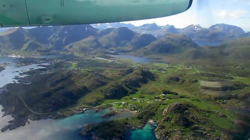
The view from the air was unbelievable as our plane landed on a sunny day…
Water shimmering in all hues… emerald green, turquoise blue,
grey and plain glittering silver. ..
This
is Bodø from the air.

This is View of Lofoten from air...

emerald green water
in some places...
Landing at Leknes. ..

Wideroe flight landed at Leknes airport.


It’s
such a small car rental place, it’s not even manned. We had to ring up our guy
to come in and rent us the car though we had specified our airline.


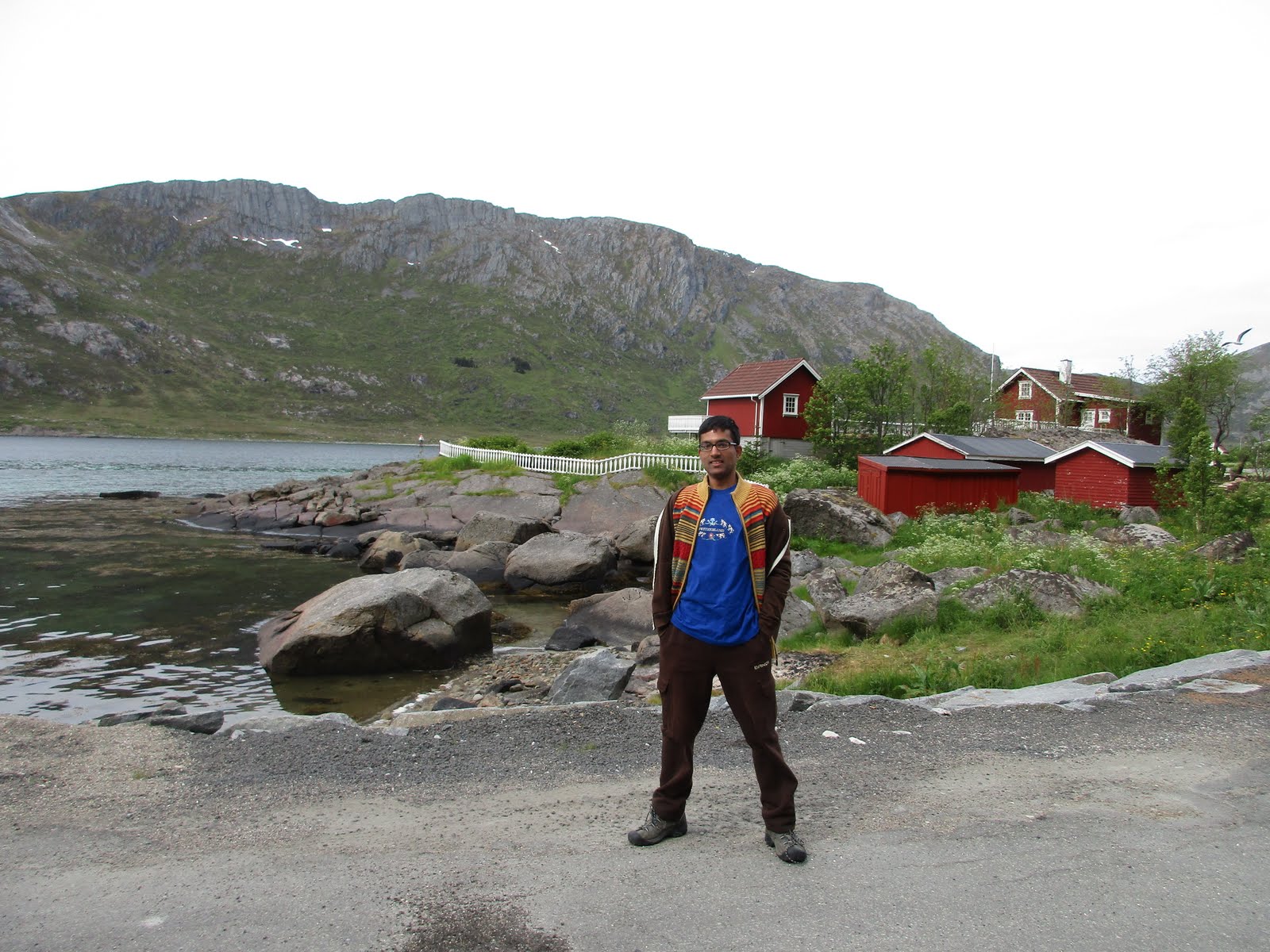
At Hagstua, we had a 2 bedroom cabin.


The deck outside has lovely
views of snow capped hills.
Lofoten (Old Norse: Lófót) was originally the old name of the island Vestvågøya. Later it became the name of the chain of islands. The first element is ló (lynx) and the last element is derived from fótr (foot). The chain of islands with its pointed peaks looks like a lynx foot from the mainland.
Another name one might come across is "Lofotveggen" or the Lofoten wall. The archipelago looks like a closed wall when seen from elevated points around Bodø or when arriving from the sea, some 100 km long, and 800-1,000 m high.
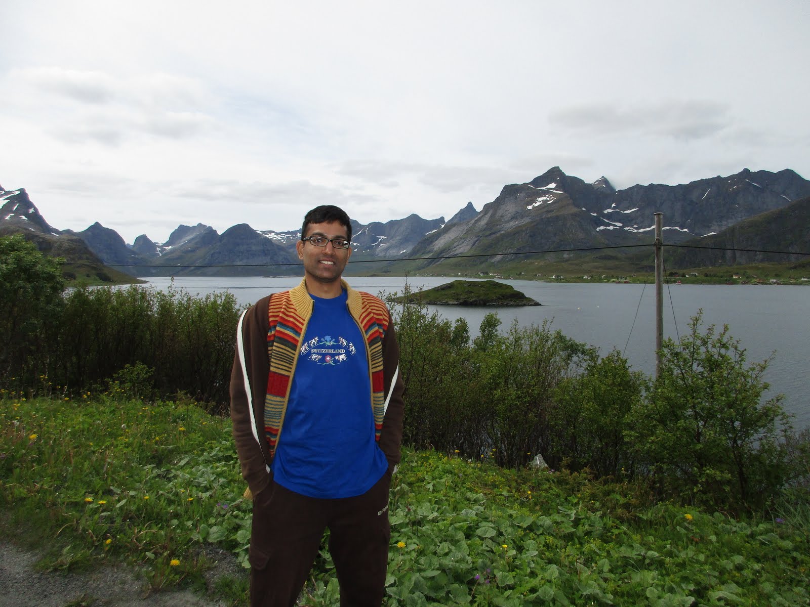
We started off on our drive.

Though lying within the
Winter temperatures in Lofoten are very mild considering its location north of the


National Tourist Route Lofoten
runs from Å to Raftsundet (Euroroute 10) with detours to Nusfjord (Road 807),
Vikten (Road 811), Utakleiv (Road 825), Unstad (Road 992), Eggum (Road 994) and
Henningsvær (Road 807). This is a total distance of 230 km. We did it over 3 days


We drove to the west and covered Uttakliev, Eggum and Unstad on our 1st
evening.


July 1, 2015:
Another bright sunny day… Leknes to Å taking all the recommended
detours as well as some of our own. Reine is indeed a jewel in the crown but
other sights are no less…
The scenic south really lived up to its reputation… Ramberg,
Nusfjord, the most photographed village Reine, up to village
of Å island of Moskenesoya


Saw Cod fish drying in the stands... people complain about the smell in reviews, but this stage had no smell...

The islands have for more than
1,000 years been the center of great cod fisheries, especially in winter,
when the cod migrates south from the Barents Sea and gathers in
Lofoten to spawn.
The islands of the Lofoten archipelago are well known for
their natural beauty. The area offers both rugged landscape and unique lighting.
Consequently, the islands have long served as an inspiration for artists, poets
and painters.


In all other places people can camp free...with their tents
or camper vans.


Everyone in Norway
enjoys the right of access to, and passage through, uncultivated land in the
countryside. The right is an old law called the allemannsrett (lit. everyman's
right), that was codified in 1957 with the implementation of the Outdoor
Recreation Act.
It is based on
respect for the countryside, and all visitors are expected to show
consideration for farmers and landowners, other users and the environment.
Roller
coaster road, green meadows/forests on both sides, snow capped mountains
beckoning ahead...

This is Nusfjord area

Bridges on streams giving access to cottages...


Nusfjord...


Ramberg beach, Flakstad...


Rambergmannen or Per Grå is a natural rock formation that is
said to be a troll. It can be seen when driving in the direction of Vestvågøy.

The tale tells that he looks so sad is that
he never got married. He was old and rich, but lonely, and one day he came to
Ramberg. There he met a beautiful girl and fell in love with her. He proposed
to her, but she did not accept, and the poor troll got so sad that he sat down
by the mountain and stayed there until the sun came up and turned him into
stone.

He still stands here today and looks at all the pretty girls in Ramberg. It is said that the
rocks which are falling down are his tears.

Next stop is at the picturesque village of Reine...


A photograph over Reine from the mountain Reinebringen is used for the front page of several tourist brochures and books.

We had no time to climb the mountain but we walked around and enjoyed the village from all angles...


Å (Norwegian pronunciation: [oː], from å meaning "stream") is a
village in Moskenes

It is located towards the southern end of the Lofoten archipelago.
Village Å (originally a farm) is first mentioned in 1567 ("Aa"). The name is from Old Norse á which means "(small) river".
The name was spelled Aa until 1917 when the Norwegian language reform changed the letter aa to å.
The village is sometimes referred to as Å i Lofoten ("i" means "in") to distinguish it from other places named Å.
It is connected to the rest of the archipelago by the European route E10 highway. This part of the highway is also called King Olav's Road.

This is Village Å square... miniature models of ships, standalone cottages, wharf...

The lady sitting at the desk behind offered to take a pic of us together...sweet of her!

We finished the southern loop by
July 2, 2015 :
Woke up to a foggy day with drizzle, started on the
northern loop and the rain cleared by the time we reached Svolver.
The clouds
created their own mystique and the ride was perfect in a different kind of way
as Mother Nature showed us another facet…

Bus has slid into the ditch. reminder to drive safe...

there were 3 mishaps witnessed by us. One was this bus . In the 2nd case, a couple were at the roadside on their phone with their vehicle in a ditch. We hoped they'll get fast help from their rental. The third case was terrible... a car totaled... overtaking and colliding with the vehicle coming in the other lane. We sincerely hope nobody was hurt... there were police cars around. Just a reminder to be careful on these roads. In some places it's just a single lane for both the directions. We slide into a pullout or reverse to find a place to pullout so that the other vehicle can pass.
When it's foggy,
there is quite another mystique.


The bridge creating an interesting effect in the trough between mountains...


We drove up to Raftsundet and quite a way beyond as there was no clear center in Raftsundet. Also there had been no rest rooms on this whole stretch. Svolver would have been a good bet but the approach road had been very gravely and we had turned back on to the main road after attempting to find the town center and Tourist info office. As said, we drove on well past Raftsundet...We managed to make a U-turn and drove back to our cabin by the evening.
July 3, 2015:
Foggy but no rain… we drove to Stamsund, then to
Ballstad, then to the Haulkland beach before calling it a day.
At Stamsund. Stamsund Hurtigruten kai....


Reached Ballstad, a lovely fishing village... We had booked our cottage here as said early in this post. No regrets about the change... though this did look authentic and pretty and was way cheaper than our cabin.


Ballstad ... colorful rorbuer (fisherman's cottage)...


We drove on to Haukland sandy beach
with emerald green water...

We had to return the car at 4 pm at the airport, our flight was at 7.15 pm to Oslo with a halt at bodo. After our drive we returned to the grounds of our cabin and had our food in the car and used the rest room in the lobby.
Then we drove to the airport.
We reached the airport by 4.30, sat around when passengers for the earlier flight at 5.25 were checking in. Wideroe guys offered to put us on the earlier flight to Bodø as the fog may prevent take off of our later flight. We gladly took the chance.
We took our scheduled flight and arrived at Oslo. Reached Oslo by 10 pm ,
We kept our big bags in ParkInn, Radisson at the airport which is at walking distance. We had an early morning flight on July 5th Sunday and so had booked the airport hotel for Saturday night. However, we wanted to be in city center in the morning and had booked a hotel there for Friday night when we landed in Oslo from Lofoten.
We kept our big bags in ParkInn, Radisson at the airport which is at walking distance. We had an early morning flight on July 5th Sunday and so had booked the airport hotel for Saturday night. However, we wanted to be in city center in the morning and had booked a hotel there for Friday night when we landed in Oslo from Lofoten.
We took the airport shuttle and then took the commuter train to Oslo S..
Reached our hotel Citybox Oslo by midnight and slept off. All these late night
activities possible because of extended day light!
It had been a great experience at Lofoten and we were very glad we had included it in our itinerary!
https://goo.gl/photos/gwB2kFevnVnu8mpG7
has our Video featuring the drives in Lofoten
covers our last day in Norway
https://goo.gl/photos/gwB2kFevnVnu8mpG7
has our Video featuring the drives in Lofoten
covers our last day in Norway
No comments:
Post a Comment