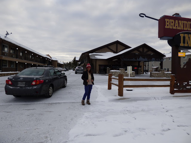
Day 5 Oct 14, 2021 Thursday:


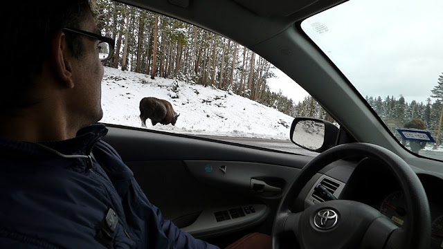
We were optimistic, but inside, the park remained cold and snowed in, in most places. Quite a few roads were closed and we spent the morning driving up & down fruitlessly.


We had initially tried going to Canyon village, but the entrance was closed. We then tried going towards Old Faithful and encountered another closed road. We tried the Canyon village entrance which was open this time. We then arrived at the Canyon Village and saw the Grand Canyon lookouts. Everywhere was snowed up and slick & dangerous in many places on the trails.
GRAND CANYON OF YELLOWSTONE
The Grand Canyon of the Yellowstone is roughly 20 miles long, measured from the Upper Falls to the Tower Fall area. The canyon was formed by erosion as Yellowstone River flowed over progressively softer, less resistant rock.


Drove on to the next lookout.


for getting to the Grand Canyon of the Yellowstone River from Canyon Village:
Turn left out of the Canyon Village parking area.
Proceed to the four-way intersection next to the service station.
Turn left at the stop sign.
For North Rim Drive (Brink of Lower Falls, Inspiration Point, Grand View Point, and Lookout Point):
Drive 1.5 miles to the sign "North Rim Drive".
Get in the left turn lane and turn left onto North Rim Drive.
For South Rim Drive (Artist Point, Uncle Tom's, and Upper Falls)
Drive 2 miles to the sign "South Rim Drive".
Get in the left turn lane and turn left onto South Rim Drive.
For Uncle Tom's, take the first left into the Uncle Tom's parking area.
For Artist Point, continue on the road for 1 mile until the road ends at the parking area.
The 109-foot (33.2-m) Upper Falls is upstream of the Lower Falls and can be seen from the Brink of the Upper Falls Trail and from Uncle Tom's Trail. The 308-foot (93.9-m) Lower Falls can be seen from Lookout Point, Red Rock Point, Artist Point, Brink of the Lower Falls Trail, and from various points on the South Rim Trail. The volume of water flowing over the falls can vary from 63,500 gallons (240,374 l)/second at peak runoff in the spring to 5,000 gallons (18,927 l)/second in the autumn.
A third falls is located in the canyon between the Upper and Lower falls. Cascade Creek cascades into the canyon as Crystal Falls. It can be seen from the South Rim Trail just east of the Uncle Tom's area.
WHERE TO SEE?
North Rim Drive: Walkways at Lookout Point and Brink of the Lower Falls lead to views of both waterfalls. The longest stretch of accessible trail can be accessed from parking lots at Lookout or Grand View. You can also see the Lower Falls from Red Rock and Inspiration points.
South Rim Drive: See the Lower Falls at Artist Point, and from a few places along the South Rim Trail; see the Upper Falls from two viewpoints at Uncle Tom’s Point. Due to improvement projects, please consult the park newspaper for the latest information concerning access.
Visit Brink of Upper Falls from a viewing area just off the Grand Loop Road south of Canyon Junction, between the entrances to North and South Rim drives.


We had already checked out of the hotel in the morning. After seeing grand canyon, we did not have the time to see any of the other sites in YNP..
We really wanted to see if the sun had made Grand prismatic clearer to see , or whether it had melted the snow off the Travertine terraces. But in our hearts, we knew that would not be the case, owing to YNP having several micro climates...and it remained cold and frozen throughout.
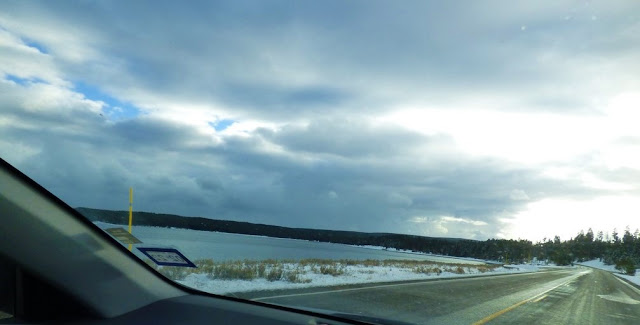
We drove down through the east side, via West thumb, Hayden valley, Grant village and reached South entrance.


TETON VILLAGE, THE HOSTEL
We put in our Teton village hotel on our phone's GPS. Even the hotel site had said it was 8 miles from Grand Teton park entrance through the Moose Wilson road. We drove on and hit up the road. It did not look like the road we had come into the Park on Oct 12. It necame narrow and steep and full of potholes. We rattled on in the dark. When just 3 miles to our hotel, the road became unnavigable. The potholes were too deep and big. We turned back and at 9 pm made the GPS route us through Jackson. It was a 40 minute drive with oncoming vehicles beaming their headlights at us but we made it to our hotel. We had earlier telephoned them we are running late. They said they'll be around till 11pm.
Snow had been drifting horizontally at us and we were just glad we were home and dry.
Checked in


slept off at 11 pm.
VIDEO LINKS
drive from branding iron inn oct 14
https://photos.app.goo.gl/LwDNC9hYjWe1EoBP8
GRAND CANYON OF YELLOWSTONE
https://photos.app.goo.gl/kPeu7uNUHwRzyFX27
drive from grand canyon to south entrance
https://photos.app.goo.gl/UQLc5ToZvRUa3az1A
TETON VILLAGE THE HOSTEL
https://photos.app.goo.gl/yGRAVzPLhVxhSAFD8
DAY 6 REPORT CONTINUES HERE
https://adventuretrav.blogspot.com/2021/11/yellowstone-and-grand-teton-trip-report_19.html
No comments:
Post a Comment